Land trusts take on community access to outdoor recreation
By Meghan Kent
In 2009, Colin Betzler moved to Sheridan, Wyoming, as the first paid executive director for the local land trust. Like for many people, the Bighorn Mountains drew him to the area. On a clear day, the fortress-like summits of Cloud Peak, Blacktooth, Innominate, and Mt. Woolsey reign over the Sheridan valley. The Bighorns’ steep cliffs and high alpine parks play backdrop to everyday life in the small town. Among neon signs and busy storefronts, business names like “Foot of the Bighorns” and “Blacktooth Brewing” bring the mountains into the downtown.
For all of Sheridan’s Bighorn Mountain pride, Betzler struggled to find close trail access. A swath of private properties separates the city from mountain trailheads. After fruitless searches down state highways and county roads, Betzler found his choices for trail access limited to driving an hour on the highway or climbing Red Grade Road, a steep, gravel path closed four months of the year. Betzler determined to create a local trail system through his role at the Sheridan Community Land Trust.
Traditionally, land trusts protect land. They hold conservation easements, in which a landowner willingly gives up development rights to a land trust to protect open space, agriculture, or wildlife values of their property. Many land trusts also purchase land outright to protect sensitive habitat, commonly referred to as “preserves.” While these agreements and holdings remain important in private land conservation, the scope of work for land trusts has broadened. As they’ve shifted to engage their communities, local land trusts have found a role in creating access to open space.
“Land trusts increasingly are seeing themselves as part of the solution to who has access to the outdoors,” says Brad Paymar, who directs programs in the western US for the Land Trust Alliance, a national organization that develops guidelines, provides resources, and advocates for conservation policy to support land trusts. In recent years, the alliance’s focus has shifted to equity and social impacts including access to the outdoors. This isn’t necessarily a new idea—for example, the Trust for Public Land was founded in 1972 with a mission to create parks and protect land for people—but growing awareness of disparity in access to greenspaces and resultant health consequences has highlighted the need for local land trusts to create access to open space. The Land Trust Alliance’s 2020 Census reports 80 percent of land trusts provide public access, up 11 percent from 2015.
Settling into his new role, Betzler heard abundant interest in the community to expand outdoor access. After consulting with other land trusts, Betzler and the Sheridan Community Land Trust board organized a small group of recreationists to identify locations for a trail system. They narrowed down a long wish list of private and public lands to a few places where trails would be accessible for the community, minimize environmental impact, and have landowner support.
The land trust had been deliberate in building community trust and was careful not to encroach on any property rights. “We weren’t standing on the edge of their property with a bulldozer,” Betzler says. Working with landowners already supportive of the organization, Betzler started “Ride the Ranch”—a series of evening group bicycle rides along two-track roads on private land. These rides were a proxy for community interest and gave landowners a taste of public access.
One landowner on the west edge of Sheridan made the access permanent. In 2013, the land trust opened Soldier Ridge Trail as a four-mile out-and-back on a ranch road. The land trust has since added a trailhead on nearby city-owned property to create 10 miles of unpaved trail, with 1.5 more miles and another trailhead planned for summer 2023. The Soldier Ridge Trails connect to the city pathway system, making access possible even without a vehicle. As they move across this working ranch, trail users experience the native range habitat protected in many of the land trust’s conservation easements.
Paymar refers to places like Soldier Ridge as “ambassador landscapes,” where people can experience the open space, wildlife, and natural values that land trusts protect. They’re often in or near urban areas, making access easy for recreators as well as school groups. This connection to place brings the community into the land trust’s mission.
As Soldier Ridge developed, Betzler and his team pursued another trail project along Red Grade Road. Thirty minutes from Sheridan, Red Grade switchbacks across a mosaic of state, BLM, and Forest Service lands. Unlike Soldier Ridge, which opened access on private properties, Red Grade had always been publicly accessible. Locals had been skiing, snowmobiling, and wandering its dense woods for decades. A trail system would expand its appeal and usability, pulling recreation traffic off the road and into the thickets. The steep foothills and rugged terrain would make destination-worthy downhill trails, but the land trust decided on a different direction.
“We don’t need it to be world class—we want it to be great for our community,” says Betzler. Instead of bike-specific trails to draw visitors, the land trust designed Red Grade for a range of non-motorized recreation. They hired a trail designer who incorporated local knowledge to create trails for uses from birding to biking and everything in between. The design also accounted for nearby landowner concerns including privacy and fear of trespass.
After years of planning, fundraising, and permitting, the land trust broke ground on Red Grade Trails in 2014. When the BLM and Forest Service requested public comment for expanding the trail system in 2015, they received more than 500 comments, over 80 percent of which specifically supported the trails. What started as four miles meandering from sagebrush foothills into the conifer forest has since grown to 17 miles, three additional trailheads, and plans to construct 16 more miles.
By the time Betzler left his position in 2017, the Sheridan Community Land Trust had built eight miles of trail across two systems; created put-in and take-out sites along Tongue River, Big Goose Creek, and Little Goose Creek for rafters; and placed a conservation easement to double the size of a city-owned natural area. Current executive director Brad Bauer continues Betzler’s vision of creating an amenity for the local community.
Community members, he says, are “the ones who have bought into building and enjoying these trails.” Seventy percent of the land trust’s funding, including for trails, comes from community supporters and local foundations. Their support is necessary to keep the trails maintained, as well. With 29 miles of trail across three systems and over 75,000 users in 2022 alone, the land trust relies on volunteer help to supplement trail maintenance. Bauer continues to look for opportunities to engage more of the community with the trails, including creating accessible trails and providing free community education such as guided hikes, history talks, and workshops.
The Sheridan Community Land Trust trail systems have become a point of pride. In the words of local trail user Jim Sorenson, “Your family is here for Thanksgiving—what do you do? You take them to Red Grade and show them around. … It’s something everyone can do.”
Meghan Kent was the summer 2020 Science Journalism Intern for Western Confluence. After earning her master’s at the University of Wyoming, she moved to Sheridan to become the Sheridan Community Land Trust’s first conservation program manager.
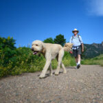
Masthead photo: The Neeson family, along with their four-footed friends Harold and Luu, enjoy the green foothills and valley views during a spring hike at Red Grade Trails. Photo Courtesy Sheridan Community Land Trust.