Conflict and collaboration in the checkerboard of Montana’s Crazy Mountains
By Shawn Regan
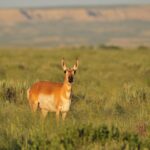
The Crazy Mountains rise sharply from the plains of south-central Montana, forming an island of rock and forest in a sea of prairie. Long a place of cultural and spiritual meaning for the Crow Tribe, the mountain range has also drawn hunters, hikers, and settlers for generations. But today, the Crazies are better known for something else: the legal and logistical knots created by their checkerboard landownership patterns.
The checkerboard in the Crazies is an accident of history—a legacy of 19th-century railroad land grants that awarded alternating square-mile sections of land to companies like the Northern Pacific in exchange for building rail infrastructure. Unlike other ranges, where homesteaders or the government later consolidated these parcels, the Crazies’ rugged terrain made their sections less attractive for settlement or buybacks. The result is a tight grid of private and public land parcels that largely remains today, forming one of the most heavily fragmented landscapes in the northern Rockies.
That legacy has turned the Crazies into a case study in the challenges of checkerboard ownership. Publicly owned parcels are often landlocked and inaccessible by recreationists or even Forest Service crews. Privately owned sections can be just as hard to reach, requiring landowners to cross public or neighboring private property for routine tasks like grazing livestock, harvesting timber, or maintaining fences. And Crow Tribal members have been blocked from reaching sacred cultural sites that would otherwise be accessible but for the fractured pattern of ownership.
Those challenges have, at times, erupted into conflict. Property owners have clashed with hikers and hunters. Lawsuits have been filed over disputed trails. And Forest Service officials have been caught in the middle, trying to navigate a legal and geographic maze that leaves no easy answers.
Amid the contention, one approach—collaboratively negotiated land swaps—has started to cut through the gridlock. By consolidating fragmented ownership and untangling jurisdictional confusion, these exchanges are beginning to create more coherent, better-managed landscapes. The work is slow and rarely glamorous, but it’s effective. And as the lessons from the Crazy Mountains are carried into similar debates elsewhere in the West, they’re becoming part of a broader conversation about land management, access, and cooperation.
![]()
Checkerboarding in the Crazies makes nearly everything more complicated. A simple hiking trip can become an exercise in forensic cartography. Hikers might consult three sources—Forest Service plats, a GPS app, and county deed filings— only to find conflicting answers about access permission. Hunters often must study detailed legal documents and public easement records to avoid trespassing.
One flashpoint has been the ongoing debate over corner crossing—the act of stepping from the corner of one public parcel in the checkerboard to another. While the legality of corner crossing is settled in the states within the 10th Circuit Court’s jurisdiction, it is generally presumed to be illegal in Montana. That means large amounts of public land in the Crazies remain inaccessible, even if they lie across from another publicly owned corner of the checkerboard.
This complexity has fueled tensions across the range. For years, trails that cross a mix of public and private parcels—like the Porcupine-Lowline and North Fork Elk Creek on the west side of the range and East Trunk and Sweet Grass on the east side—have been at the center of bitter access disputes involving easement claims. Although these routes appear on some historic Forest Service maps, the agency never formally established easement rights where these trails cross private land.
Some landowners posted signs on their property declaring that the public cannot access these trails without permission. Hikers and hunters were occasionally cited for trespass in areas they said they thought they had access to, and locked gates and missing trail signs in disputed areas added to the confusion and distrust. Then, in 2019, access advocates sued the Forest Service, demanding that the agency assert access rights to some of these areas.
In 2022, a federal court sided with the agency, finding that no such easements existed. But the decision left relationships between recreationists and landowners strained. By the time the case was decided, years of fighting had deepened mistrust and hardened local divisions—all without producing a single new acre of public access. In some places, the push to open more access even backfired, spurring landowners to tighten control over their properties. Concerned about prescriptive easement claims—legal rights-of-way that can be established if the public uses a route openly, continuously, and without permission for a set number of years—landowners have responded by posting “No Trespassing” signs, locking gates, or otherwise making clear that access is by permission only. While legally prudent, these steps closed off routes that may have once operated under informal agreements, reducing access, eroding goodwill, and adding another layer of tension to an already divided landscape.
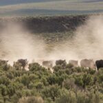
Beyond recreational access, wildfire suppression, habitat restoration, and routine forest management all become more complicated when agencies and landowners must navigate a patchwork of ownership. Without road easements to allow legal access through checkerboard corners, land managers must find costly workarounds to get themselves and their equipment to parcels needing attention. Even with access, coordinated work can require the consent of multiple entities, each with their own priorities.
Consider one example from the northeastern edge of the range where a ranching family sparred with the Forest Service for years over road access to private inholdings within the checkerboard. They wanted to conduct timber and fire management, at one point threatening to build a road with or without approval and even bringing the matter to Montana’s congressional delegation. Before the issue could be resolved, disaster struck. In 2021, a wildfire broke out, burning more than 20,000 acres of public and private lands in the same area where the family had been pressing to reduce fire risks by clearing dead and downed timber. The episode underscored how the checkerboard doesn’t just complicate recreation opportunities, it can also hamper proactive land management.
![]()
Despite the long history of disputes, the Crazies have also become a proving ground for collaborative solutions. In recent years, some of the most significant progress hasn’t come from lawsuits or agency decrees, but from landowners, conservationists, Tribal representatives, and public officials sitting down to negotiate win-win proposals that can improve both access and land management. These efforts take time, require compromise, and rarely satisfy everyone. But they have shown that, even in one of the West’s most divided landscapes, it’s possible to move beyond the checkerboard stalemate.

One example is the South Crazy Mountains Land Exchange, finalized in 2022. The deal consolidated land ownership in the southern part of the range by trading approximately 2,000 acres of inaccessible public parcels for a similar amount of scattered private inholdings. The exchange also secured two additional easements to improve public access to the southern end of the range. The result was a clearer boundary, improved management, and more public access, all without reducing the overall acreage of public land. The agreement took more than a decade to complete and drew little fanfare, but it ultimately created a landscape that is easier for both landowners and recreationists to navigate.
Years later, a more ambitious proposal on the east side of the range built on this same model. After years of stalemate over disputed trails and hypothetical prescriptive easements, a coalition of hunters, conservationists, Tribal representatives, landowners, and access advocates—working together as the Crazy Mountain Access Project—sat down to work out a deal. The proposal called for the Forest Service to trade seven inaccessible public parcels to private landowners in exchange for 10 private parcels that would become public and could be reached without crossing private property. Combined with existing holdings, the acquired tracts would create a 30-square-mile block of contiguous public land and secure formal access for the Crow Tribe to Crazy Peak, one of the most culturally significant sites in the range.
The deal also included the construction of a new 22-mile loop trail, designed to give the public reliable access to this area without trespass disputes. In a creative twist, the deal funded this by incorporating a smaller exchange of several parcels in the nearby Madison Range, where a ski resort sought to expand its terrain. As part of the package, the resort agreed to cover the cost of building the new trail in the Crazies more than 70 miles away—tying together two entirely different mountain ranges through a single negotiated exchange. The Forest Service ultimately adopted the group’s proposal as the East Crazy Inspiration Divide Land Exchange, and after several years of public review and environmental analysis, it formally authorized the swap in 2025.
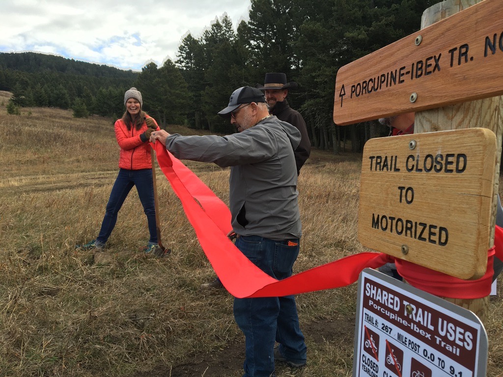
Not every solution requires trading land. In some cases, cooperation has focused on adjusting how the public reaches the land that is already theirs. In the Porcupine Ibex area on the west side of the range, the Forest Service worked with private landowners to reroute a popular trail that had previously crossed a checkerboard of public and private parcels. The old route had been the source of repeated trespass disputes, as sections passed through private property without deeded easements. Rather than fight over historic use, the parties agreed to construct a new trail that stays almost entirely on public land, while the landowner donated an easement for the trail to cross a portion of private land. The result is a trail that connects visitors to the high country but eliminates legal uncertainty.
And when it comes to crossing private land, the Forest Service has increasingly focused on negotiated solutions rather than contentious efforts to assert access rights in court. That approach is beginning to pay off. In one recent case, negotiations with a ranching family produced a permanent, legally recorded trail easement that opened public access to the northeastern edge of the range. The agreement grants a two-mile corridor across private property to reach thousands of acres of previously inaccessible national forest land, demonstrating how cooperation can succeed where confrontation has failed.
![]()
For all their potential, land exchanges and other cooperative arrangements are not a silver bullet. They are complicated, time consuming, and often politically sensitive. The South Crazy Mountains and East Crazy Inspiration Divide swaps were the product of years of negotiation, legal reviews, appraisals, and public meetings. To finalize an exchange, the Forest Service must clear a series of procedural hurdles under federal law, including environmental analyses under the National Environmental Policy Act and appraisals to ensure the exchanged parcels are of equal value. Each step can take months or years to complete, and these drawn-out timelines can be enough to discourage otherwise beneficial land swaps.
But bureaucratic hurdles aren’t the only challenge. In many cases, the parcels the public gives up are lower-elevation lands that offer better wildlife habitat for hunting than the higher-elevation, rock-and-ice parcels the public receives in return. Yet those lower-elevation parcels are also the ones most valuable for ranching or development, making them prime candidates for consolidation into larger, contiguous private holdings. Balancing those competing priorities can be one of the most contentious aspects of any proposed swap.
Another sticking point comes from conditions the Forest Service often attaches to the private parcels it conveys. In many swaps, the agency seeks to require that landowners place conservation easements on their newly acquired parcels to protect habitat or prevent subdivision. While such restrictions may align with public goals, they have made exchanges less appealing to some landowners, who may be reluctant to limit how their land can be used in the future. Negotiating these conditions—which are not required by federal law—adds another layer of complexity that can derail or slow down land swaps.
For these reasons, successful land swaps remain the exception, not the rule. Ultimately, such exchanges are as much a relationship-building exercise as a real estate transaction. It takes years to get there, and in the Crazies, that patience is slowly, but steadily, paying off.
![]()
Much of the Crazy Mountains remains checkerboarded, and that won’t change overnight. But the recent examples of rerouted trails, negotiated easements, and land exchanges offer a glimpse of what progress can look like. It all starts with collaborative approaches that allow for genuine public-private partnerships.
It also requires better information. Groups like the Theodore Roosevelt Conservation Partnership and onX are helping map landlocked parcels and provide information about public access gaps. Transparency helps identify priorities and build support for finding creative ways to close those gaps. These tools not only promote access but also increase awareness about how checkerboarding impacts both recreation and conservation.
And it takes forums for discussion. The Crazy Mountain Access Project brought together diverse groups to look for common ground. These efforts don’t eliminate disagreement—they create space for productive conversation. And they help establish norms of engagement that can replace the threat of litigation with the possibility of cooperation.
The Crazies show that even in one of the West’s most divided landscapes, cooperation can prevail to resolve conflicts in the checkerboard—one trail, exchange, or agreement at a time. The lessons learned here can inform efforts to untangle checkerboards across the West.
Shawn Regan writes from Bozeman, Montana. He is a senior fellow at the Manhattan Institute.
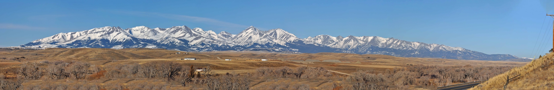
Header image: The Crazy Mountains. (Ecoflight)