Mix of public and private lands causes fire management challenges
By Kristen Pope
A bolt of lightning crashes down and hits some brush, which begins to smolder. The wind transforms wisps of smoke into visible flames and the small fire quickly becomes a mass of orange flames—headed straight for neighboring homes. If this small ignition occurred on one of the six million acres of public land in the western US that are completely surrounded by private land, it would be more likely to become a bigger, more problematic fire, according to researchers.
Fire management is more challenging in areas where public and private lands meet, whether they are completely “stranded” or another part of the wildland-urban interface. The mix of land ownership types and uses can lead to very different objectives and approaches. One community in Oregon is taking on these challenges through a cooperative public-private effort that works with landowners to prepare for wildfires and reduce the risk of catastrophic fire in the first place.
The mix of public and private lands that shapes parts of the wildland-urban interface results from a number of factors, including policies from the time of westward expansion. During the 19th century, government grants were made along the new transcontinental railroad corridors to encourage people to build nearby, with every other parcel becoming private, and remaining parcels reserved by the government. Today, many of these reserved parcels are still public land, surrounded by private land and forming what’s known as the “checkerboard” pattern found in some parts of the West.
University of Wyoming associate professor Bryan Leonard and colleagues explored how these and other lands surrounded by private lands, which they refer to as stranded lands, impact fire considerations in a 2021 article in Environmental Research Letters. The researchers studied fires that ignited on western public lands between 1992 and 2015 and found that ignitions on stranded public land were 14-23 percent more likely to grow to over an acre than other fires. They also analyzed the impact using 5-acre and 160-acre thresholds, and found similar results— that ignitions on stranded public lands are more likely to get bigger than those on more accessible public lands.

They also found that fires on stranded public lands were more likely to escape the crucial “initial attack” phase of firefighting, which involves rapid containment efforts that occur within the first one to eight hours after an ignition and is a key indicator of how large fires are likely to ultimately become. “If it stays small, the damages are going to be pretty limited, but as soon as it escapes that initial containment then it’s much more likely to become problematic,” Leonard says. Overall, they found that fires on stranded public lands become 18 percent larger than those that began on public land that is accessible.
In certain states, including Montana, Nevada, and Wyoming, the fires that began on stranded lands made up 10 percent of acres burned, in spite of only making up 3-6 percent of ignitions. Leonard and his colleagues also found that, on average, stranded fires were two to three times as large as non-stranded fires in these states
Not every state had the same results, though. In a few other states, including Colorado, Idaho, New Mexico, Oregon, and Utah, the 1 percent of fires that started on stranded public lands only accounted to 0.27-1.5 percent of the area burned in those states.
“I expect this has to do with differences in the extent and nature of stranded lands across these different states,” Leonard says. “Montana, Nevada, and Wyoming have some of the most extensive checkerboarding of private and public land thanks to the legacy of the railroad land grants. While not all checkerboarded lands are stranded, the two are often highly correlated, and it is not hard to imagine that conducting fire management activities is more difficult in a highly checkerboarded landscape than in one with a relatively isolated stranded parcel.”
Vegetation type, in addition to land ownership, may have contributed to this difference between states. “Most of the stranded lands in these three states are grasslands, which are associated with the faster initial spread of fires,” Leonard says.

The reasons why fires that start on parcels of stranded public lands are more likely to become large could be related to difficulty of accessing those lands for management, detection, and response. Even before a fire sparks, fuels management can reduce the threat of wildfire, including mechanical thinning, prescribed fire, and invasive weed management. “While many public lands are in need of additional fuels treatment, this problem is systematically worse on stranded land due to access issues,” Leonard says. In the study, stranded lands were 5 percent less likely to be the focus of management projects.
“The same access issues can also complicate and slow the ‘initial attack’ once fires start, by creating confusion and logistical hurdles associated with determining land ownership and obtaining access, says Leonard. Even when private landowners are eager for assistance with fires and fire management on these lands, there can be barriers to access like locked gates that take up time. Leonard says, “These issues might be compounded in settings where the landowners have a less than amicable relationship with public land managers due to past access disputes.”
While stranded public lands can lead to significant fire management hurdles, these only represent one type of situation where public and private lands coming together complicates fire management. The wildland-urban interface (known as the “WUI”) is a transitional area where human development abuts undeveloped wildland vegetation, and is often found where public and private lands meet. The WUI has grown rapidly in recent decades, increasing by 33 percent from 1990 to 2010. A 2018 study found that houses in these areas are increasing by 41 percent, and that the WUI is the fastest-growing land use type in the Lower 48. That growth is attributable to multiple factors.
“[The WUI is] a beautiful place to live. Most people who care about the environment would like to live closer to nature, maybe see wildlife from their kitchen window,” says Volker Radeloff, a professor in forest and landscape ecology at University of Wisconsin-Madison and one of the authors of the study. “The other major factor is that downtown areas are expensive to live in and there’s a housing crisis, and so some people are also pushed out of urban areas and they have to move out into the wildlife-urban interface because that’s the only place they can afford to live. When we look at the WUI, it spans the gamut. There is Malibu WUI, but also trailer parks, and every socioeconomic group is found in the WUI.”

USDA Forest Service Northern Research Station
The continuing growth of the WUI is problematic for both fire risk and fire management. “If a fire occurs it places more people at risk. They have to be evacuated, firefighters have to focus on protecting structures, and so forth,” Radeloff says. “The other side of that coin is that most fires are started by people, so the people living in those landscapes, the power lines, barbecue grills toppling over, arson, the whole suite of different reasons for ignitions—they are all concentrated.”
This is particularly true in the kind of WUI called the intermix because it involves homes dotted among the vegetation. In contrast, the other type of WUI, interface WUI, involves high-density housing near a large tract of wild area. Interface WUI areas may have less vegetation to burn and more hard barriers, like roads and pavement, that can act a fire breaks, but when fires impact these areas, they can race through neighborhoods quickly, igniting house to house.
The WUI also poses challenges to fire preparedness. When landowners have different management objectives—and budgets—it can be challenging to find good solutions. One private landowner may prefer a thick forest close to their home for privacy and wildlife observation, whereas a nearby homeowner may prioritize creating defensible space for fire protection. A public parcel of land might be managed for ecosystem services, while a timber tract may focus on maximizing the price of timber products.
“If you have ten private landowners, they have twelve different opinions about how to manage the land, and there are different objectives,” Radeloff says. “One will prioritize aesthetics over fire safety, over biodiversity values, over income from timber harvesting, and so forth. In the wildland-urban interface where houses are, the land is privately owned so it becomes very hard to coordinate and do something like a prescribed burn unless all landowners are in agreement.”

Finding solutions to fire management when dealing with a variety of public and private landowners can be a challenge, but a partnership near Klamath Falls, Oregon, is working to reduce fire danger and promote forest health where public and private lands intermingle. The Chiloquin Community Forest and Fire Project (CCFFP) uses cross-boundary management to improve forest health while working on fire resistance and response.
The project focuses on a 38,800-acre area that is 60 percent forested and at high fire risk. The Chiloquin area includes large tracts of national forest, with fingers of private land interspersed, largely running alongside waterways. It is a complex WUI area with a mix of land ownership types and both industrial and nonindustrial uses.
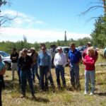
“There are a lot of subdivisions that may be completely surrounded by Forest Service [land] or surrounded on three sides by Forest Service, so there is a lot of interface between the private and the public land in Chiloquin area,” says Leigh Ann Vradenburg, project manager for Klamath Watershed Partnership, which is the watershed council overseeing the project. In her role, she works with federal and state agencies, nonprofits, and private landowners on ecosystem restoration projects in the Upper Klamath Basin.
CCFFP maps and inventories the region to identify priority treatment areas and obtains grants to reduce fire risk, including money for private landowners to manage fuels on their own land. Outreach is a key component of this effort, including meetings, workshops, mailings, phone calls, and on-the-ground visits. Vradenburg and partners also collaborate with larger forest health and wildfire resiliency projects to do large-scale planning efforts. She says CCFFP has more than 32 landowners participating, and the project has already treated more than 4,400 acres of private land.
One of the barriers they face is landowners’ reluctance to treat their land if neighboring parcels are not doing fuel treatments. People in rural communities also like their privacy, she says, which includes visual barriers, such as trees separating them from roads and public lands where people might be recreating. However, she works to build trust and overcome these barriers.
“We’re non-regulatory, we’re non-threatening,” Vradenburg says. “We come in from the position of advocating for the landowner and helping them to understand what the forest could and should look like but then also understanding what their needs are. Do they run cattle out there or have objectives for timber harvest? We’re working to support them in their forest management and land management goals.”

CCFFP is part of the Chiloquin Wildfire Initiative, which is a partnership with Chiloquin Fire and Rescue that focuses on creating defensible space around homes and helping landowners treat small properties, including providing brush trailers to help people haul off materials. Additionally, they are increasing outreach and education efforts, with plans to go to local schools and events to educate people about wildfire.
Cooperative public-private efforts like this initiative rely on the willingness of government entities and private landowners to work together to meet fire management challenges. “I think we were fortunate to have a good community to work with,” Vradenburg says. “Sometimes it takes all the players in the right places and Chiloquin has been an example of that and the success of that is shown by the acres treated and the landowners involved and so it’s something we’re really proud of.”
Kristen Pope is a freelance writer who lives in the Tetons. Find more of her work at kepope.com.
Header image: 2013 Alder Fire in Yellowstone National Park (Mike Lewelling/National Park Service)